
With Thanks To Ali Chestnuut , Chestnutt Holdiday park

There are a number of features of interest
Lighthouses
The Haulbowline Lighthouse and the two lights immediately behind at Greencastle assisting navigation of the the Lough These mark the safe limits of navigation onward into the Lough toward the Ports of Newry and Warrenpoint and are known as Vidal bank (Orange Arrow Up) and Green Island (Orange Arrow Down ) see below The Haulbowline Lighthouse was finished in 1824 and is 135 feet high 100 feet wide at its base and 20 feet wide at the top. It is made from granite and is solid up to about 40 feet. It has 8 floors in it and used to house three lighthouse keepers. A stone lighthouse built circa 1803 on Cranfield Point marked the entrance to Carlingford Lough before the Haulbowline lighthouse was built.the keeper's house continued in use as a shore station for Haulbowline until 1922.
There is also another Lighthouse at Greenore Point when they where built and accounted for circa 1840 they cost £ 849 17 s and £ 249 11 s 1 d respectfully. The likely origins from the Norse of meaning “Haulbowline” is derived from the Norse “Aale-bolig” meaning eel location or den. Like many of the Irish Lighhouses these fall under the remit of The Commisioner of Irish Lights


© Copyright Albert Bridge and licensed for reuse under this Creative Commons Licencee
Haulbowline Range Rear (Green Island) & Haulbowline Range Front (Vidal Bank) Lights The lights are screw-pile lattice steel structures with a small housing for the light on top. The rear structure, Green Island, is 13.7m (45 feet) high above high water and the front structure, Vidal Bank, is 8.8m (28 feet) high. They are 457m (500 yards) apart. Fixed white lights were established on 28th February 1873 and the structures were painted red with a white housing for the light, which at that time was an oil lamp.

There is also another Lighthouse at Greenore Point when they where built and accounted for circa 1840 they cost £ 849 17 s and £ 249 11 s 1 d respectfully. The likely origins from the Norse of meaning “Haulbowline” is derived from the Norse “Aale-bolig” meaning eel location or den. Like many of the Irish Lighhouses these fall under the remit of The Commisioner of Irish Lights
Haulbowline Lighthouse
© Copyright Terry Stewart and licensed for reuse under
Creative Commons Licence.
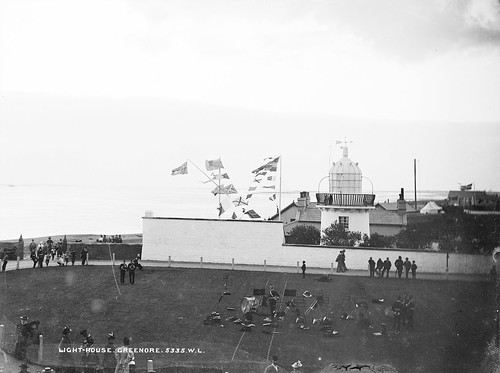
Greenore Point
This image was taken circ 1860
Inactive since 1986
Haulbowline Range Rear (Green Island) & Haulbowline Range Front (Vidal Bank) Lights The lights are screw-pile lattice steel structures with a small housing for the light on top. The rear structure, Green Island, is 13.7m (45 feet) high above high water and the front structure, Vidal Bank, is 8.8m (28 feet) high. They are 457m (500 yards) apart. Fixed white lights were established on 28th February 1873 and the structures were painted red with a white housing for the light, which at that time was an oil lamp.
Forts
The Blockhouse Island ( AKA Nun's Island or Ennis Moore ( Great Island ). This substantive piece of History was lost in 2002 to storm and rising sea level . Blockhouse Island (a guano pile in springtime) lies between Sheep Rock and Haulbowline Lighthouse, is bigger than either but is not named on the OS map.The Blockhouse was an Elisabethan Artillery Fort previously known as Carlingford Fort constructed on this Island to fortify and protect the mouth of Carlingford from invaders . The precise date of building is debatable and speculated to be around 1605 - 1642 ). The postcard below shows what the structure was like up to relatively recently . The Island is now leased to the RSPB as a sanctuary for seabirds (see above star shaped structure to the left of the Haulbowline Lighthouse )

With Thanks To Ali Chestnuut , Chestnutt Holdiday park
Castles
Greencastle is a Norman Castle built in the 13th century. On the other side of the Lough in Co Louth there is another Castle Carlingford Castle also known as King Johns Castle - Carlingford was occupied approximately 800 years ago by Norman knight Hugh de Lacy after laying the foundation stone for a castle on a strategic outcrop of rock. Its naming King Johns Castle derived from the supposed fact that King John stayed here for 3 days in 1210. The castles were built by Hugh de Lacy (see below) almost certainly during the 1230s to protect the southern approaches to the Earldom of Ulster.
From its commanding position it controlled the ferry link with Carlingford and defended sea and land communications. Due to various attacks on the castle over time, the building standing to day is a mix of 13th – 16th Century structures.
For centuries the green below the castle played host to a great fair every August. It was often called "Ram Fair" as a great ram was customarily enthroned on top of the castle's walls.
Greencastle was held for the English Crown by Richard de Burgh, Earl of Ulster, from 1264-1333. It was attacked and taken by Edward Bruce, the brother of Robert, in 1316. This was in spite of one of Richard de Burgh's daughters having married Robert the Bruce himself. It was attacked at least twice by the Irish in the later 14th century but still maintained as an English garrison in the 1590s. In the 1500s it was held by the Earl of Kildare and then Nicholas Bagenal of Newry. It fell into disuse after a bombardment by Cromwellian soldiers, to stop it being used by rebel forces.In 1505 it was granted to the Earls of Kildare, but after their downfall in 1534 quickly deteriorated into a "wret ched condition". The place was later granted to the Bagnals who lived here until 1635. It was bombarded and destroyed by Parliamentary forces in 1652.
Greencastle


Images Courtesy of Anderson-Ivor


Narrow Water Castle
Narrow Water Castle

Image Courtesy Wilson Adams Wiki Commons Licence
WW2 Airfield - RAF Greencastle - USAF Base

Douglas A-20G Havoc A bomber Type Flown From RAF Greencastle

Above : Greencastle Airfield-26-Oct-1942

Above : Greencastle Airfield circa 1960's
Many of the buildings still exist but are in a derelict condition. The basic layout of the station can still be seen from above but the signature of the runways is gone. A caravan site occupies much of the southernmost portion.. In the 1960s the runways were all broken up and used by farmers in walls, Greencastle has one of the best preserved instructional sites in Northern Ireland
Greencastle was a training base, known as a Combat Crew Replacement Centre , CCRC giving skills to new crews in gunnery and bombing techniques, and making up replacement for crews lost in action.
The 2 storey buildings were used as Air Ministry Laboratories/bombing teacher blocks. AML These buildings are listed category B1 as former WW2 structures having interest as industrial archaeology.


In these AML - Air ministry Laboratories a Bombing trainer known the Vickers-Bygrave Bombing Teacher.was used to simulate realistic projections

Eisenhower and Patton flew into Greencastle in the months leading up to D-Day to inspect troops of the US 5th Infantry Division stationed throughout County Down (their HQ was at Donard Lodge in Newcastle).


Below A topographic Map of the Mourne Mountain Range to the Nooth of Carlingford Lough CLICK to magnify. The Principle Coastal Town to the Esst is Newcastle

Dundrum Castle castle, situated above the town of Dundrum, County Down NW of New castle and protecting the mouth of Dundrum Bay It was constructed by John de Courcy, sometime near the beginning of the 13th century, following his invasion of Ulster. The castle, built to control access into Lecale from the west and south, stands on the top of a rocky hill commanding fine views south over Dundrum Bay and the Mourne Mountains, the lands west towards Slieve Croob and the plains of Lecale to the east.
 John de Courcy 1160 – 1219 a.d was a Norman knight who served Henry II in England and France before coming to Ireland in 1176.Gerald of Wales a chronicler descibed the knight as ‘fair-haired and tall with bony and sinewy limbs’ and possessing ‘immense bodily strength’,
de Courcy launched a daring attack on Ulster in 1176, with a force of 22 knights and 300 Anglo-Norman troops.

He consolidated his control over much of the north east and built Carrickfergus and Dundrum Castles. De Courcy founded a number of monastic sites, such as Inch and Grey Abbey and encouraged the cult of Saint Patrick.
Appointed Justiciar of Ireland in 1185, de Courcy expanded his territories as far north and west as Coleraine and raided as far as Inishowen in
1199. De Coucy had his own currency at Carrickfergus & Downpatrick and ruled this territory for 30 years. He eventually posed such a challenge to royal authority in Ireland that he was finally expelled by his rival Hugh de Lacy in 1203.
De Courcy's original castle likely had defences of earth and timber, but it is probable that the stone curtain wall of the upper ward was built at the beginning of the 13th century. As with other early enclosure walls, there were no towers, but defence was assisted by covered walks along the outside wall-head. An early timber hall may have been sited near the keep, where there is a double-latrine in the curtain wall.
Custody of Dundrum Castle was committed to Walter de Lacy in 1226 and inthe following year it was restored to Hugh de Lacy In 1203 de Courcy was expelled from Ulster by Hugh de Lacy.and defeated 1204 The earliest reference to the castle occurs in the mid 13th century Chronicle of Mann, which records of de Courcy's unsuccessful attempt to siege "the castle of Rath" in 1205, with the aid of one hundred ships of his brother-in-law, Ragnvald Godredsson, King of the Isles

Dundrum Castle, Co Down, Ireland, 1791

Image Thanks to Jamey Cassell
Clough Castle

Images Courtesy of Ardfern CC BY-SA 3.0

Images Courtesy of Ardfern CC BY-SA 3.0

Images Courtesy of Ardfern CC BY-SA 3.0
No comments:
Post a Comment